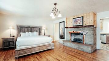
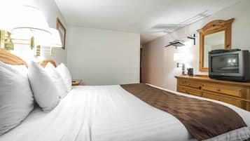
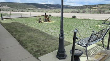
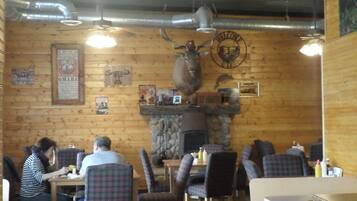
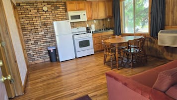
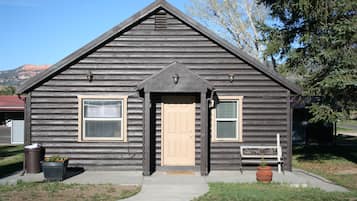
Photo by Eric & Kristy's Adventures
Find hotels in Alton, UT from ¥8,265
- Change your mindBook hotels with free cancellation
- Be pickySearch almost a million properties worldwide
Go beyond your typical stay in Alton
Family friendly
Cabin
Check prices for these dates
Our top choices for Alton hotels

7.8 out of 10, Good, (1005)
The price is ¥10,570
¥11,935 total
includes taxes & fees
Feb 8 - Feb 9

9.0 out of 10, Wonderful, (1004)
The price is ¥13,681
¥15,720 total
includes taxes & fees
Jan 25 - Jan 26
The price is ¥11,135
¥12,574 total
includes taxes & fees
Feb 8 - Feb 9

9.2 out of 10, Wonderful, (490)
The price is ¥12,131
¥13,820 total
includes taxes & fees
Feb 8 - Feb 9

8.0 out of 10, Very Good, (21)
Lowest nightly price found within the past 24 hours based on a 1 night stay for 2 adults. Prices and availability subject to change. Additional terms may apply.
Save an average of 15% on thousands of hotels when you're signed in
Stay near popular Alton attractions
Learn more about Alton
Nestled near the stunning Dixie National Forest, this tiny town offers hikers access to Red Hollow Canyon Trailhead and Mammoth Cave. Explore the natural wonders of Bryce Natural Bridge and Fairview Point, where southern Utah's remarkable landscapes unfold in every direction.
![Take Hwy 89 through the Dixie National Forest. Hot in summer. Beautiful area to explore.
Dixie National Forest is a United States National Forest in Utah with headquarters in Cedar City. It occupies almost two million acres (8,000 km²) and stretches for about 170 miles (270 km) across southern Utah. The largest national forest in Utah, it straddles the divide between the Great Basin and the Colorado River. In descending order of forestland area it is located in parts of Garfield, Washington, Iron, Kane, Wayne, and Piute counties. The majority (over 55%) of forest acreage lies in Garfield County. There are local ranger district offices in Cedar City, Escalante, Panguitch, St. George, and Teasdale.[3]
Elevations vary from 2,800 feet (850 m) above sea level near St. George, Utah to 11,322 feet (3,451 m) at Blue Bell Knoll on Boulder Mountain. The southern rim of the Great Basin, near the Colorado River, provides spectacular scenery. Colorado River canyons are made up of multi-colored cliffs and steep-walled gorges.
The Forest is divided into four geographic areas. High altitude forests in gently rolling hills characterize the Markagunt, Paunsaugunt, and Aquarius Plateaus. Boulder Mountain, one of the largest high-elevation plateaus in the United States, is dotted with hundreds of small lakes 10,000 to 11,000 feet (3,000 to 3,400 m) above sea level. The forest includes the Pine Valley Mountains north of St. George
The Forest has many climatic extremes. Precipitation ranges from 10 inches (250 mm) in the lower elevations to more than 40 inches (1,000 mm) per year near Brian Head Peak 11,307 feet (3,446 m). At the higher elevations, most of the annual precipitation falls as snow. Thunderstorms are common during July and August and produce heavy rains. In some areas, August is the wettest month of the year.
Temperature extremes can be impressive, with summer temperatures exceeding 100 degrees Fahrenheit (38 degrees Celsius) near St. George and winter lows exceeding -30 degrees Fahrenheit (-34 degrees Celsius) on the plateau tops.
The vegetation of the Forest grades from sparse, desert-type plants at the lower elevations to stand of low-growing pinyon pine and juniper dominating the mid-elevations. At the higher elevations, aspen and conifers such as pine, spruce, and fir predominate.
The Dixie Forest Reserve was established on September 25, 1905 by the General Land Office. The name was derived from the local description of the warm southern part of Utah as "Dixie".[4] In 1906 the U.S. Forest Service assumed responsibility for the lands, and on March 4, 1907 it became a National Forest. The western part of Sevier National Forest was added on July 1, 1922, and all of Powell National Forest on October 1, 1944.[5] #RoadTrip](https://images.trvl-media.com/place/553248623139890761/0fda4c56-7838-41e8-8b93-58002efa6942.jpg?impolicy=fcrop&w=900&h=696&p=1&q=high)
Photo by Eric & Kristy's Adventures
Open Photo by Eric & Kristy's Adventures
More cheap stays in Alton

Rodeway Inn Bryce Canyon
3090 UT 12 Panguitch UT
The price is ¥7,320 per night from Feb 8 to Feb 9
¥7,320
¥8,265 total
Feb 8 - Feb 9
includes taxes & fees
8/10 Very Good! (1,004 reviews)
Frequently asked questions
Explore a world of travel with Expedia
- Family Hotels in Bryce Canyon
- Lodges in Tropic
- B&B in Bryce Canyon
- Cabin Rentals in Southwestern Utah - Bryce Canyon
- Hotels near Cottonwood Canyon Rd
- B&B in Panguitch
- Inns in Kanab
- Cheap Hotels in Glendale
- Tropic Hotels
- Lodges in Southwestern Utah - Bryce Canyon
- Hotels near Angels Landing
- Hotels near Zion National Park East Entrance
- Hotels near Brian Head Ski Resort
- Resorts in Summit
- Motels in Glendale
- Guest Houses in Duck Creek Village
- Lodges in Panguitch Lake Resort
- Hotels near Mammoth Cave
- Resorts in Panguitch Lake Resort
- Hotels near Mossy Cave Trail
- Ranches in Panguitch
- Hotels near Utah Shakespeare Festival
- Rv Parks in Hatch
- Hotels near Navajo Lake
- Farmstay in La Verkin
- Glendale Hotels
- Cedar City Hotels
- Hotels near Zion Canyon Visitor Center
- Vacation Homes in La Verkin
- Cheap Hotels in Cedar City
- Hotels near Zion National Park South Entrance
- Palaces in Springdale
- Hotels near Zion Canyon Scenic Dr
- Motels in Big Water
- Cheap Hotels in Apple Valley
- Motels in Mount Carmel
- Family Hotels in Brian Head
- Guest Houses in Springdale
- Adventure Hotels in Bryce Canyon
- Hotels near Bryce Canyon National Park
- Inns in Bryce Canyon
- Rv Parks in Mount Carmel
- Rv Parks in Southwestern Utah - Bryce Canyon
- Resorts in Alton
- Kanab Hotels
- Mount Carmel Junction Hotels
- Motels in Bryce Canyon
- All-Inclusive Hotel Hotels in Kanab
- Cheap Hotels in Bryce Canyon
- Hotels near Bryce Natural Bridge
- Hostels in Bryce Canyon
- Shopping Hotels in Bryce Canyon
- Riads in Bryce Canyon
- Family Hotels in Kanab
- Cheap Hotels in Brian Head
- Bryce Canyon Hotels
- Resorts in Brian Head
- Aparthotels in Cedar City
- Rockville Hotels
- Cabin Rentals in Tropic
- Ranches in Bryce Canyon
- Motels in Kanab
- Resorts in Cedar City
- Riads in Kanab
- Cabin Rentals in Panguitch
- Guest Houses in Bryce Canyon
- Resorts in Bryce Canyon
- Holiday Park Resorts in Bryce Canyon
- Lodges in Bryce Canyon
- Hotels with Early Check-in in Bryce Canyon
- Villas in Brian Head
- Ryokans in Bryce Canyon
- B&B in Hildale
- Rv Parks in Rockville
- Rv Parks in Kanab
- Holiday Park Resorts in Southwestern Utah - Bryce Canyon
- Pousadas in Kanab
- Aparthotels in Summit
- Aparthotels in Tropic
- Pensions in Bryce Canyon
- Paria Hotels
- Hotels near The Narrows
- Duck Creek Village Hotels
- Ski Hotels in New Harmony
- Hotels near Sunrise Point
- Hotels near Coral Pink Sand Dunes State Park
- All-Inclusive Hotel Hotels in Cedar City
- Luxury Hotels in Bryce Canyon
- Hotels near Bryce Point
- Hotels near Red Canyon
- Springdale Hotels
- Hotels with Free Parking in Kanab
- Inns in Springdale
- Rv Parks in Bryce Canyon
- Hotels near Zion National Park
![Take Hwy 89 through the Dixie National Forest. Hot in summer. Beautiful area to explore.
Dixie National Forest is a United States National Forest in Utah with headquarters in Cedar City. It occupies almost two million acres (8,000 km²) and stretches for about 170 miles (270 km) across southern Utah. The largest national forest in Utah, it straddles the divide between the Great Basin and the Colorado River. In descending order of forestland area it is located in parts of Garfield, Washington, Iron, Kane, Wayne, and Piute counties. The majority (over 55%) of forest acreage lies in Garfield County. There are local ranger district offices in Cedar City, Escalante, Panguitch, St. George, and Teasdale.[3]
Elevations vary from 2,800 feet (850 m) above sea level near St. George, Utah to 11,322 feet (3,451 m) at Blue Bell Knoll on Boulder Mountain. The southern rim of the Great Basin, near the Colorado River, provides spectacular scenery. Colorado River canyons are made up of multi-colored cliffs and steep-walled gorges.
The Forest is divided into four geographic areas. High altitude forests in gently rolling hills characterize the Markagunt, Paunsaugunt, and Aquarius Plateaus. Boulder Mountain, one of the largest high-elevation plateaus in the United States, is dotted with hundreds of small lakes 10,000 to 11,000 feet (3,000 to 3,400 m) above sea level. The forest includes the Pine Valley Mountains north of St. George
The Forest has many climatic extremes. Precipitation ranges from 10 inches (250 mm) in the lower elevations to more than 40 inches (1,000 mm) per year near Brian Head Peak 11,307 feet (3,446 m). At the higher elevations, most of the annual precipitation falls as snow. Thunderstorms are common during July and August and produce heavy rains. In some areas, August is the wettest month of the year.
Temperature extremes can be impressive, with summer temperatures exceeding 100 degrees Fahrenheit (38 degrees Celsius) near St. George and winter lows exceeding -30 degrees Fahrenheit (-34 degrees Celsius) on the plateau tops.
The vegetation of the Forest grades from sparse, desert-type plants at the lower elevations to stand of low-growing pinyon pine and juniper dominating the mid-elevations. At the higher elevations, aspen and conifers such as pine, spruce, and fir predominate.
The Dixie Forest Reserve was established on September 25, 1905 by the General Land Office. The name was derived from the local description of the warm southern part of Utah as "Dixie".[4] In 1906 the U.S. Forest Service assumed responsibility for the lands, and on March 4, 1907 it became a National Forest. The western part of Sevier National Forest was added on July 1, 1922, and all of Powell National Forest on October 1, 1944.[5] #RoadTrip](https://images.trvl-media.com/place/553248623139890761/0fda4c56-7838-41e8-8b93-58002efa6942.jpg?impolicy=fcrop&w=1200&h=500&q=medium)


